
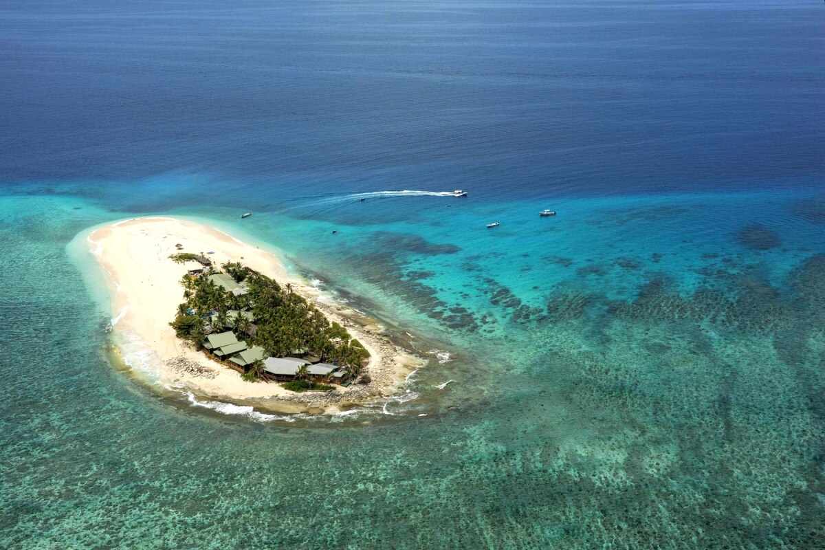
A problem for people who already have their feet wet today on the Frisian Halligen or island states in the Pacific, as well as for residents of large coastal cities from New York City to Jakarta to Rostock, is a troubling surprise: the sea level is higher than previously assumed. A study has now found that existing models estimate coastal sea levels on average 20 to 30 centimeters too low.
The team led by Katharina Seeger and Philip Minderhoud from Wageningen University in the Netherlands examined 385 studies in their meta-analysis. The scientists found a systematic underestimation of the sea level. They reviewed studies from 2009 to 2025 that used satellite-based height data. They noted that in nine out of ten cases the local sea level was referenced solely on the basis of land elevation measurements.
“However, the sea level is influenced by additional factors such as winds, ocean currents, tides, as well as the temperature and salinity of seawater,” explains Minderhoud. “Therefore, the actual height can deviate.” The researchers speak of a blind spot that previous studies had overlooked. According to the scientists, data on local sea level rise in coastal regions must be treated fundamentally differently. The team corrected the incorrect reference value with their own calculations.
Thus, the rise in sea level due to the climate crisis could affect many more people. “Our corrected calculations show that with a relative rise in sea level of one meter, 37 percent more area and 68 percent more people – up to 132 million – would fall below sea level,” says Seeger.
A fundamental error is being corrected
“The study does not adjust sea level forecasts, but corrects a fundamental error in the previous risk assessment,” said Ingo Sasgen of the Helmholtz Centre for Polar and Marine Research (AWI) in Bremerhaven to the Science Media Center, who was not involved in the study himself. The work is methodologically very well executed. Central is that “the absolute height of today’s sea level relative to the coast in risk studies was systematically set too low – and thus also the number of people who would be affected by a future rise in sea level,” Sasgen said.
The bad news for the Pacific island states acutely threatened by sea level rise: according to the research team, previous studies have especially underestimated the sea level in Southeast Asia and the Indo-Pacific. It could already be one meter higher there than previously assumed. In regions such as Europe or North America there are more resources for collecting local measurements – therefore, there will be less reliance on the less accurate models. In the Global South, satellite data are often the only available data source.
What the study brings to light is alarming, says Gabriel Mara. The analyst works at the think tank Climate Analytics in Berlin on adaptation and damages in the Pacific region, was also not involved in the study himself, and is currently in the Pacific state of Tuvalu. For small island states, it is not a purely theoretical discrepancy. “Because if the projections are conservative, then the policies, infrastructure standards and adaptation plans based on these projections will be conservative too.” For the island states, that means in plain terms: not secure.
The climate crisis is accelerating
Global warming is accelerating even more. This is shown by a study published on Friday that re-evaluates the extent of the climate crisis. The work by Grant Foster and Stefan Rahmstorf of the Potsdam Institute for Climate Impact Research (PIK) shows that the rate of warming has increased since 2015.
What is special about the work is that the authors have excluded contextual factors such as the cyclical weather event El Niño, during which global temperatures are higher than usual, independent of the climate crisis. The scientists write in the journal Geophysical Research Letters that, from 1970 to 2015, the planet warmed by an average of 0.2 degrees Celsius per decade; since 2015, the average has been 0.35 degrees.


